瀏覽次數:466by:柏際股份
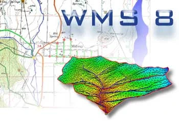
WMS 水層建模暨模擬軟體 流域建模系統 (WMS) 的所有階段的流域水文和液壓系統綜合圖形模環境。 WMS 包括功能強大的工具來自動建模過程如自動的流域分、 幾何參數計算、 地理資訊系統覆蓋計算

WMS 水層建模暨模擬軟體
流域建模系統 (WMS) 的所有階段的流域水文和液壓系統綜合圖形模環境。 WMS 包括功能強大的工具來自動建模過程如自動的流域分、 幾何參數計算、 地理資訊系統覆蓋計算 (CN、 雨量深度、 粗糙度係數等)、 地形資料截面提取和更多 ! 該發行所的 WMS 8 版軟體現在支援水文建模與港燈-1 (港燈 HMS) 合理方法 TR-55 從事 TR-20 MODRAT OC 理性和 HSPF。 支援的水力模型包括港燈 RAS、 SMPDBK 和行政長官優質 W2。 現在,可以進行 (包括通道液壓系統與地下水相互作用) 的 2D 集成的水文建模與 GSSHA。 基於地理資訊系統的資料處理框架中這一切將使流域建模和映射比以往任何時候更容易的任務該程式的模組化設計使使用者可以選擇允許使用者選擇只有這些水文建模能力所需的自訂群組合中的模組。其他WMS模組可以購買,並可以隨時添加。 軟體動態將在運行時連結到這些後續模組—自動向該軟體添加額外的建模能力。
The Watershed Modeling System (WMS) is a comprehensive graphical modeling environment for all phases of watershed hydrology and hydraulics. WMS includes powerful tools to automate modeling processes such as automated basin delineation, geometric parameter calculations, GIS overlay computations (CN, rainfall depth, roughness coefficients, etc.), cross-section extraction from terrain data, and many more! With the release of WMS 8, the software now supports hydrologic modeling with HEC-1 (HEC-HMS), TR-20, TR-55, Rational Method, NFF, MODRAT, OC Rational, and HSPF. Hydraulic models supported include HEC-RAS, SMPDBK, and CE QUAL W2. 2D integrated hydrology (including channel hydraulics and groundwater interaction) can now be modeled with GSSHA. All of this in a GIS-based data processing framework will make the task of watershed modeling and mapping easier than ever before
想要了解更多http://www.bockytech.com.tw/
歡迎您與我們聯繫,我們必會竭誠為您股務!!
#GSSHA#WMS#地理資訊系統#流域建模系統#流域水文#液壓系統#相互
